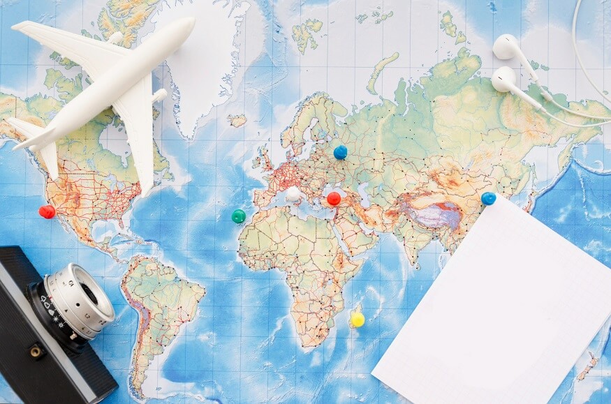
The Earth has seven large areas of land known as continents with 195 countries in total. The seven continents are Asia, Europe, Africa, North America, South America, Australia, and Antarctica. About 71% of our planet is covered by water, while the remaining 29% is land. This land is split into the seven continents mentioned earlier.
Understanding how many continents are there in the world
Our planet has seven continents, each with unique characteristics and attractions. Asia is the biggest and is celebrated for its vibrant culture and varied landscapes. Africa is the second largest continent renowned for its amazing wildlife and beautiful deserts.
North America and South America are linked by a small land bridge and feature lively cities alongside breathtaking natural sights. Antarctica is a cold and remote continent, with little population and mainly explored by researchers. Europe boasts a rich history and is filled with art, culture, and impressive structures. Australia, also known as Oceania, is encircled by the vast Pacific Ocean and is famous for its distinct wildlife.
Asia
Asia is the largest continent on Earth, both in size and population. It is a giant among continents, stretching over 44,579,000 square kilometres on a map, you can see it is bordered by the Pacific Ocean to the east, the Arctic Ocean to the north, the Indian Ocean to the south, and Europe to the west.
Asia has many amazing features, including some of the tallest mountains and the two most populous countries. It occupies about one-third of the Earth’s land area.
Asia is on the right side of the world map located in the Eastern Hemisphere. The United Nations recognises 48 countries in Asia, along with some smaller regions. Interestingly, two countries, Russia and Turkey, have land in both Asia and Europe.
Russia, the largest country in the world, is part of Asia. As of 2021, over 4.6 billion people lived in Asia, making it home to the most populous nations. Additionally, Asia boasts the tallest mountains on the planet.
Europe
Europe is the sixth-largest continent and has a large population. It is a big piece of the Earth’s puzzle! You may have heard of Eurasia, which combines Europe and Asia. Although they are connected, we see them as different continents because of their unique languages and cultures. Europe consists of 50 countries.
Imagine Europe as a jigsaw piece with water on three sides. The Arctic Ocean is to the north, the Atlantic Ocean to the west, and the Caspian Sea to the southeast. In the south, there are two important seas: the Mediterranean and the Black Seas.
Here is an interesting fact: Europe’s eastern edge is defined by the Ural and Caucasus Mountains. They act like a natural barrier between Europe and Asia.
Africa
Africa is the second-largest continent globally, following Asia. It is not only vast but also contains 54 countries and over 16% of the world’s population.
Think of Africa as a huge piece of a puzzle on the world map. It is bordered by the Atlantic Ocean to the west, the Mediterranean Sea to the north, the Red Sea and the Indian Ocean to the east, and more oceans to the south.
Most of Africa is located in the Northern Hemisphere, which means it is in the upper half of the world map. It is also home to the vast Sahara Desert, the largest desert on Earth, filled with endless dunes and intense heat. Additionally, Africa has the Nile River, the longest river in the world, flowing like a long snake across the continent.
There are also nine smaller regions, similar to younger siblings, visible on the map.
Fun fact: around 15% of the global population resides in Africa. That’s a significant number of people!
Algeria is the largest country in Africa, while Seychelles is the smalles. Lastly, Africa is home to Lake Victoria, the second-largest lake in the world.
North America
North America is a large part of the Earth, ranking as the third biggest continent. It ranks fourth in terms of population. This continent consists of 23 countries and is located in the northern hemisphere.
North America covers 24,709,000 square kilometres. It is bordered by the Arctic Ocean to the north, the Atlantic Ocean to the east, and the Pacific Ocean to the west. To the south, it shares a border with South America.
One of the most interesting fact about North America is a narrow land bridge called the Isthmus of Panama that links North America to South America, acting like a natural walkway. The Bering Strait serves as a water boundary between North America and Asia.
South America
South America ranks as the fourth largest continent by size and the fifth in population. It consists of 12 countries and is located in the southern part of the globe, with a small section extending into the western hemisphere.
South America covers 17,840,000 square kilometres. It is bordered by the Atlantic Ocean to one side, the Pacific Ocean to the other, and the Southern Ocean below. To the north, it shares a border with North America.
South America is home to the Amazon Rainforest, often referred to as the “lungs of Earth”. This incredible rainforest plays a vital role in providing fresh air for our planet. In summary, South America is a large, green mass of land surrounded by oceans, featuring a crucial rainforest that contributes to the health of our world.
Australia
Australia is the smallest continent on Earth. It is extremely flat and dry. Despite its large area, it is not highly populated, coming in second place after Antarctica. Overall, 14 countries are part of this continent.
Australia covers 8,525,989 square kilometers of area. Some people refer to the entire area as “Oceania” to avoid mixing it up with the country. About 60 million years ago, Australia separated from Antarctica, taking some animals with it. These animals evolved over time and became unique species found only in this region.
In summary, Australia is a small continent with its distinct animals and an interesting history of separation from Antarctica.
Antarctica
Antarctica is an amazing place. It is the fifth-largest continent on Earth, but interestingly, it has no countries or permanent residents. Scientists and their teams come to this icy land for research and stay for a limited time.
Imagine Antarctica as a huge frozen island, spanning 14,200,000 square kilometers. It is an extremely chilly region, bordered by the Southern Ocean. In summary, Antarctica serves as a snowy research centre where scientists visit to explore this one-of-a-kind, cold continent.
Discovering our planet shows us its amazing variety and beauty. Every continent, country, and natural feature shares a tale of nature’s wonders and human success. As we keep exploring and learning about these places, we develop a greater appreciation for our world.
At Center Point School, we encourage curiosity and exploration in our students. By studying the continents, countries, and natural features of the world, we hope to inspire future global citizens who are informed, caring, and eager to make a positive difference. Let’s keep exploring, learning, and growing together!


